 map02
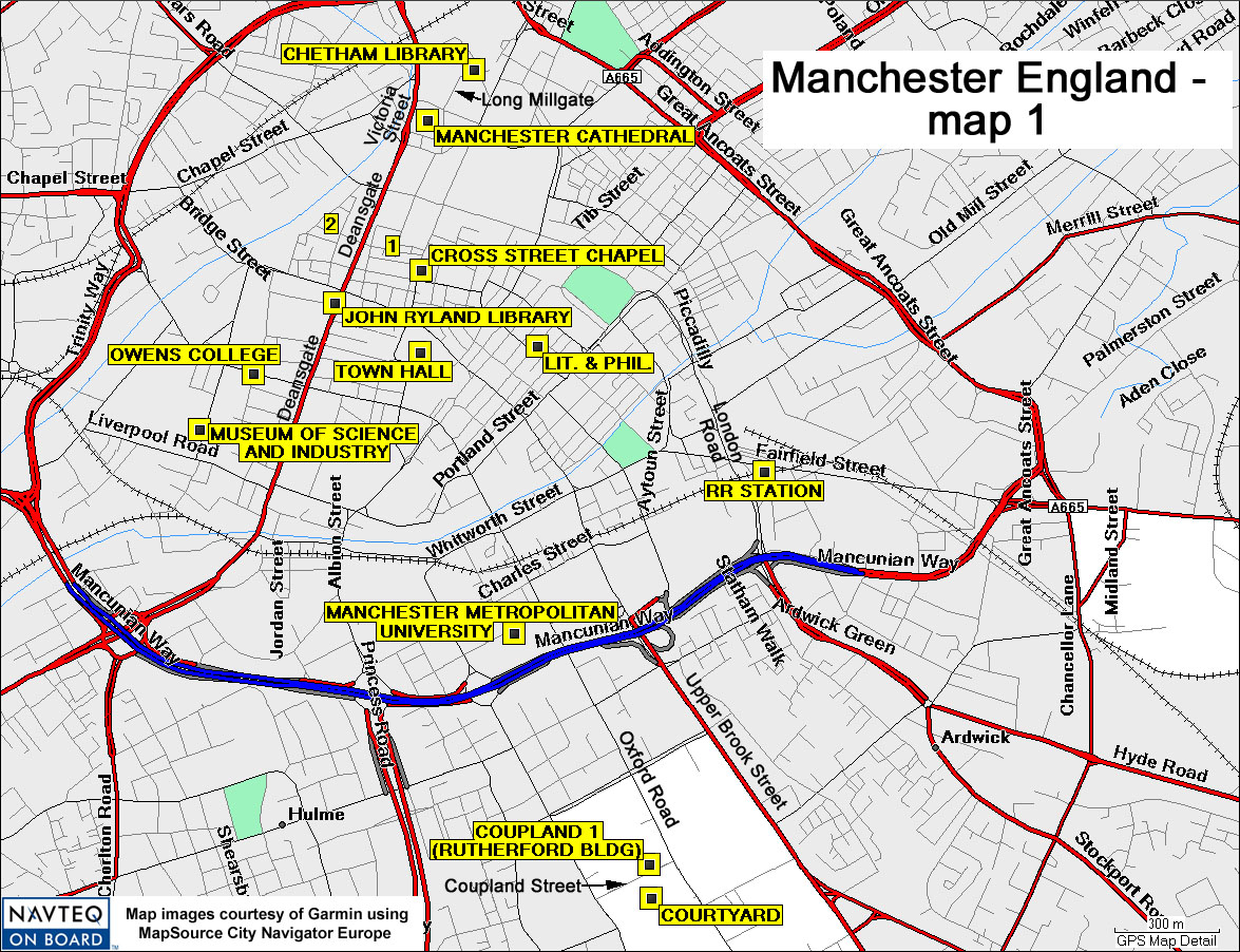
map02Directions:
Chetham Library, Dalton visited here for literature researches,
Long Millgate - N53 29.19 W02 14.55.
Manchester Cathedral, prominent landmark in early maps, still exists, Victoria
Street - N53 29.12 W2 14.68.
Cross Street Chapel, early Lit. & Phil. meetings held here, Cross Street
- N53 28.90 W02 14.68.
John Ryland Library, holds archival information about Dalton, Deansgate - N53
28.82 W02 14.90.
Owens College (now a barrister's office building), where Roscoe prepared metallic
vanadium, now Cobden House Chambers, 19 Quay Street, SW corner of Byrom Street
and Quay Street - N53 28.72 W02 15.12.
Town Hall, marble statues of Dalton and Joule, Ford Maddox Brown's famous mural
paintings, including one of Dalton; Albert Square - N53 28.77 W02 14.66.
Lit. & Phil. (Literary and Philosophical Society), destroyed in WWII raid
(December 1940); now Devonshire House, blue plaque, 36 George Street - N53 28.76
W02 14.38.
RR Station, Piccadilly Railway Station, London Road - N53 28.58 W02 13.79.
Museum of Science and Industry, numerous exhibits on Dalton, Roscoe, etc., Liverpool
Road - N53 28.63 W02 15.25.
Manchester Metropolitan University, site of Dalton bronze statue, Chester Street
- N53 28.32 W02 14.44.
[Old] Coupland 1 Building (now called Rutherford Building, as of 2006; caution!
[old] Coupland 2, just to the west [not shown on map], is now called Coupland
1), site of Rutherford's pioneering studies on the atomic structure, includes
blue plaque; Coupland Street - N53 27.96 W02 14.08.
Courtyard, University of Manchester, WWI tribute to Moseley - N53 27.93 W02
14.05.
"1" = St. Ann's Church, prominent landmark in early maps, still exists,
St. Ann Street - N53 28.91 W02 14.74.
"2" = St. Mary's Church, prominent landmark in early maps, no longer
exists; now Parsonage Gardens (a park), St. Mary's Street - N53 28.96 W2 14.91.
 map02
map02