Directions:
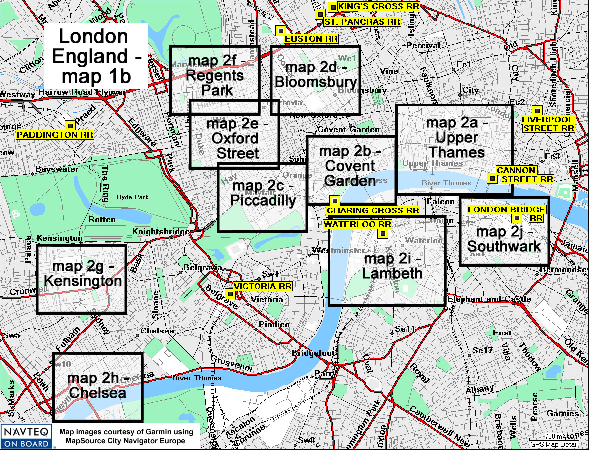
The maps 2a-2j of the inner city of London are identified here, arranged in a roughly counter-clockwise sequence beginning with the northeast quadrant. Refer to the individual maps for specific waypoints and their descriptions.
Also in this map: London has an extensive railway system, and
the intercity stations are identified and described here.
London Paddington Station, since 1838, serves cities to the west, Praed Street
- N51 31.04 W0 10.65.
Euston Railway Station, since 1837, serves the Northwest and Scotland, Euston Road, Euston Road - N51 31.72 W0 08.07.
St. Pancras Railway Station, since 1868,serves north to Yorkshire, also direct line via Waterloo and Chunnel using the Eurostar to Paris and Brussels (before 2008 the terminus was Waterloo, not St. Pancras), Euston Road - N51 31.80 W0 07.50.
London King's Cross Railway Station, since 1852, north and east connections, as far as Scotland, Euston Road - N51 31.93 W0 07.40
Liverpool Street Station, since 1874, serves cities to the east, Liverpool Street - N51 31.12 W0 4.88
Cannon Street Station, since 1866, serves south and east, Cannon Street - N51 30.62 W0 05.45
London Bridge Station, since 1836, the oldest station in London, interchange service to other statinons and to Gatwick, Duke Street Hill - N51 30.30 W0 05.16.
London Waterloo Station, since 1848, busiest in England, serves southwest and suburbs of London; was the London terminus of Eurostar to the Continent ("Chunnel") 1994-2007, York Road - N51 30.19 W0 06.74
Charing Cross Railway Station, since 1864, connections to Waterloo and London Bridge, 12-30 Strand - N51 30.45 W0 07.39
London Victoria Station, since 1862, second busiest in London, serves east and south including Gatwick, also the Orient Express, Wilton Road - N51 29.80 W0 08.69
